Karuma Falls, Kiryandongo | Uganda Attractions
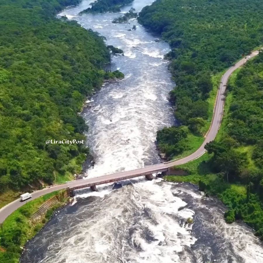
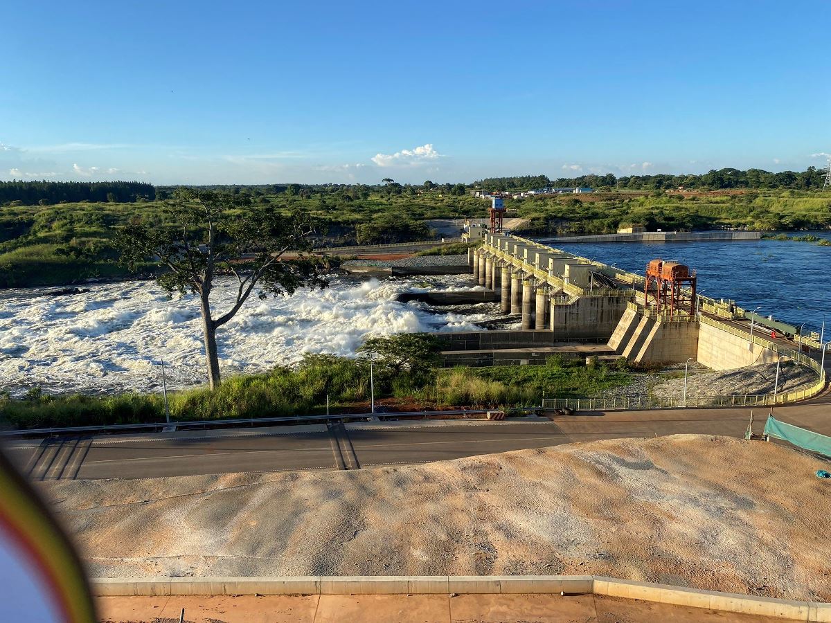
Karuma Falls stands as one of Uganda's most impressive natural and engineering landmarks, located along the Victoria Nile in the Kiryandongo District of western Uganda.
This powerful cascade, also known as Karuma Hydroelectric Power Station site, combines raw natural beauty with significant renewable energy production, drawing visitors interested in eco-tourism, wildlife, and sustainable development.
Karuma Falls Location and Accessibility
Karuma Falls sits approximately 280 kilometers north of Kampala, Uganda's capital, near the town of Karuma on the Kampala-Gulu Highway.
Travelers reach the falls via well-maintained roads, with the journey from Kampala taking about 4-5 hours by car.
The site lies close to Murchison Falls National Park, making it an ideal stop for those exploring northern Uganda's attractions.
Public buses and private tours frequently include Karuma Falls in itineraries focused on the Nile River and regional hydropower projects.
Natural Features of Karuma Falls, Uganda
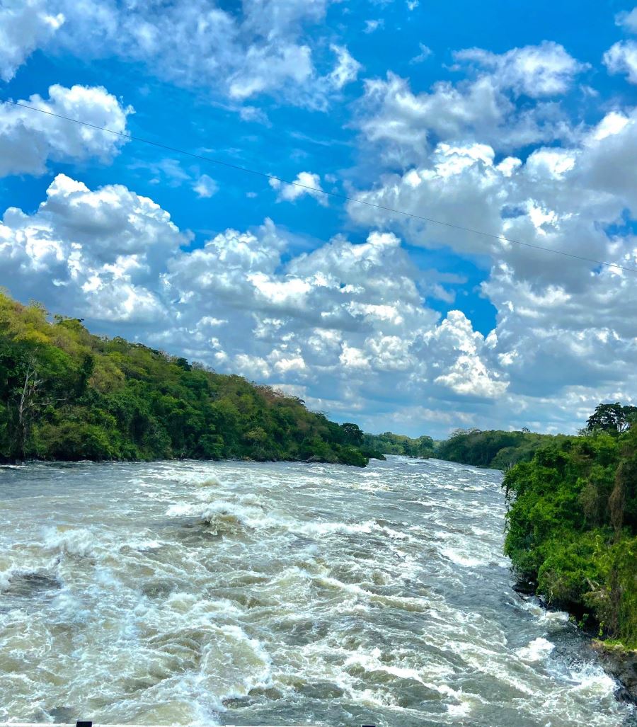
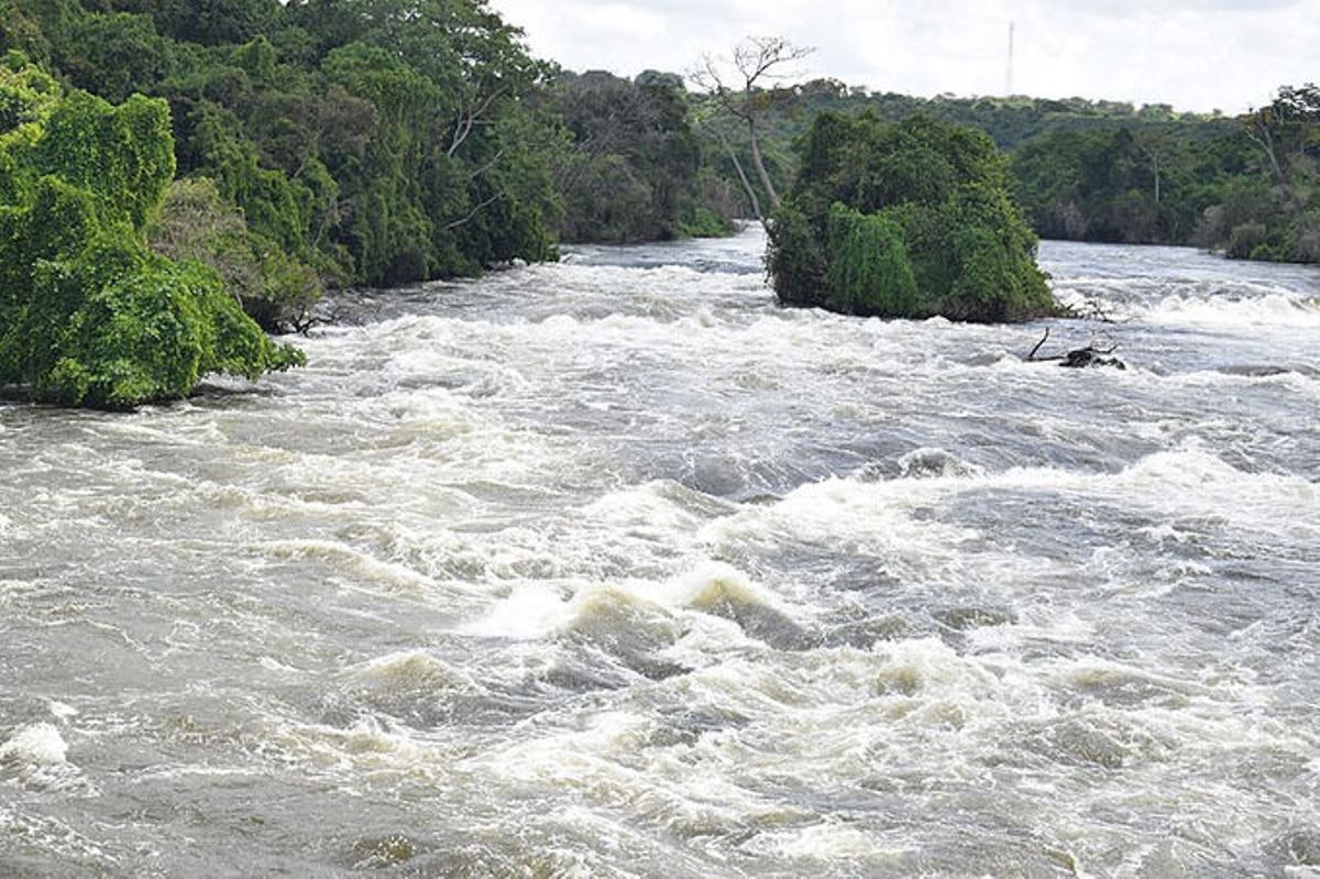
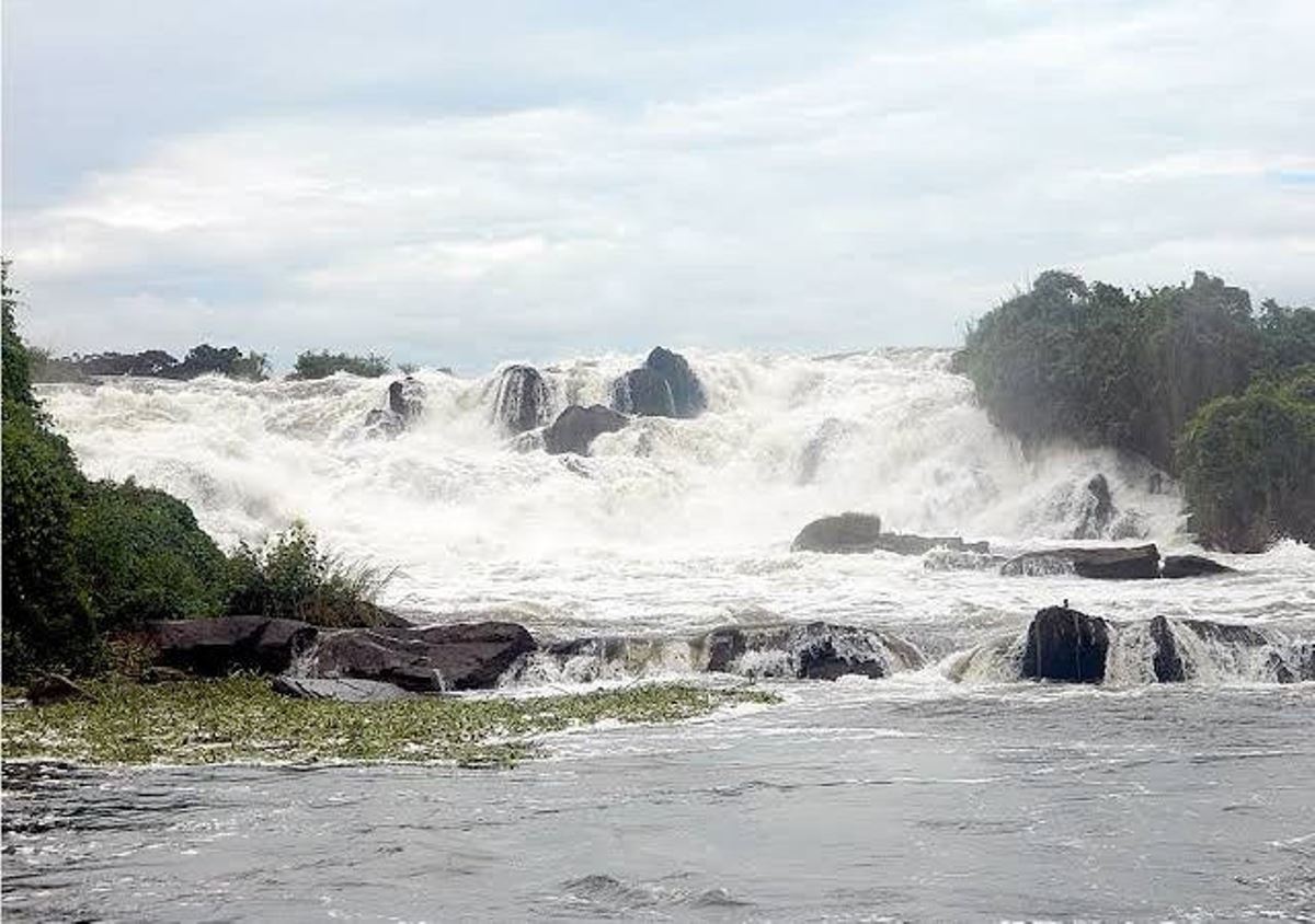
The Karuma Falls feature a dramatic drop where the Victoria Nile narrows and plunges over rocky ledges, creating a thunderous display of white water.
Surrounding vegetation includes lush riverine forests that support diverse birdlife and small mammals.
The Nile's flow here remains strong year-round, fed by Lake Victoria and regional rainfall, ensuring consistent water volume even during dry seasons. Visitors often observe rainbow mists rising from the base, especially during sunny afternoons.
Karuma Hydroelectric Power Station Details
Completed in recent years, the 600 MW Karuma Hydroelectric Power Station harnesses the falls' energy through underground tunnels and turbines.
This underground design preserves much of the surface landscape, allowing the waterfall to remain visible and accessible.
The project supplies clean electricity to Uganda's national grid, supporting industrial growth and rural electrification efforts across the country.
Karuma Falls History, Uganda
Karuma Falls holds a rich historical timeline along the Victoria Nile in Uganda's Kiryandongo District.
This section traces the falls' evolution from prehistoric geological formation through colonial-era exploration, post-independence planning, and completion of the Karuma Hydroelectric Power Station, providing comprehensive details for researchers, tourists, and energy enthusiasts searching for authentic Ugandan heritage.
Geological Origins of Karuma Falls, Uganda
Karuma Falls formed thousands of years ago as the Victoria Nile carved through rift valley rock formations.
Tectonic activity in East Africa created the narrow gorge where water accelerates and drops approximately 7 meters over basalt ledges.
Sedimentary evidence shows consistent river flow since the Pleistocene era, establishing the site as a permanent feature on Uganda's longest river system.
Pre-Colonial Significance in Local History
Indigenous communities, including the Acholi and Langi peoples, recognized Karuma as a vital river crossing point centuries before European arrival.
Oral traditions describe the falls as "Karuma," meaning "the place where the river roars" in local dialects.
Fishermen used natural pools below the cascade for centuries, while traders navigated upstream routes connecting Lake Kyoga to Lake Albert.
The site's strategic location facilitated cultural exchanges across northern Uganda's ethnic groups.
Colonial-Era Exploration and Documentation (1890s–1960s)
British explorer John Hanning Speke first mapped the broader Nile course in 1862, but detailed records of Karuma Falls emerged during Sir Samuel Baker's 1870s expeditions.
Baker noted the site's potential for water power in his journals. By the 1920s, Uganda Protectorate surveyors conducted formal assessments, identifying Karuma among several Nile sites suitable for future electricity generation.
Early 20th-century photographs captured the untouched cascade, preserved in Kampala's national archives.
Post-Independence Hydroelectric Planning (1960s–1990s)
Following Uganda's independence in 1962, the government prioritized energy self-sufficiency. Initial feasibility studies for Karuma Falls commenced in 1968 under the Uganda Electricity Board.
Engineers evaluated flow rates averaging 1,000 cubic meters per second, confirming viability for large-scale hydropower.
Political instability delayed progress until the late 1990s, when renewed surveys incorporated updated seismic data and environmental impact models.
Construction Timeline of Karuma Hydroelectric Power Station (2000s–2020s)
| Year | Activity |
| 2008 | Uganda signs agreements with international partners for project financing |
| 2013 | Groundbreaking ceremony marks official construction start |
| 2015–2018 | Excavation of 9-kilometer underground tunnels and powerhouse caverns |
| 2019 | Installation of six 100 MW Francis turbines manufactured in China |
| 2022–2023 | Progressive commissioning of generating units |
| 2024 | Full 600 MW operational capacity achieved, connecting to national grid |
The underground design minimized surface disruption, preserving the visible waterfall for ongoing tourism.
Key Historical Milestones at Karuma Falls
| Year | Event |
| Pre-1800s | Indigenous use as fishing and trade crossing |
| 1872 | Documented by Samuel Baker during Nile expeditions |
| 1925 | First colonial hydropower survey report |
| 1968 | Independence-era feasibility study launched |
| 1998 | World Bank-funded environmental assessment |
| 2013 | Construction begins with Sinohydro Corporation |
| 2024 | Power station reaches full commercial operation |
Cultural and Economic Impact Through History
Karuma Falls transitioned from a natural landmark to a national asset generating over 4,000 GWh annually.
Revenue supports infrastructure in Kiryandongo District, including schools and health centers.
Local communities participate in guided tours, sharing Acholi folklore about the river spirit inhabiting the falls.
The site now employs hundreds of Ugandan engineers and technicians trained during construction.
Preservation Efforts in Karuma Falls History
Heritage organizations collaborate with Uganda Wildlife Authority to maintain buffer zones around the cascade.
Archaeological surveys conducted before dam works uncovered Stone Age tools near riverbanks, now displayed at Uganda Museum.
Water release schedules ensure minimum ecological flow, sustaining downstream fisheries that communities have relied upon for generations.
The history of Karuma Falls Uganda illustrates continuous human interaction with the Victoria Nile, evolving from ancient sustenance source to contemporary renewable energy hub.
This progression reflects Uganda's broader journey toward sustainable development while honoring natural and cultural legacies.
See photos and videos taken at Karuma Falls attraction and explore places nearby. Check out Karuma Falls Attraction Gallery