Bundibugyo Travel Guide | Uganda Western Region
Bundibugyo Town, the administrative and cultural hub of Bundibugyo District in western Uganda, is a gateway to some of the country's most pristine natural wonders.
Located approximately 378 kilometers (about a 6-7 hour drive) west of Kampala, the capital, the town sits at an elevation of around 900 meters above sea level in the Bwamba County region.
Bordered by Lake Albert to the north, Kabarole District to the east, Kasese District to the south, and the Democratic Republic of the Congo (DRC) to the west, Bundibugyo is uniquely positioned west of the Rwenzori Mountains, making it feel like a bridge between East and Central African ecosystems.
The district, which was carved out of the former Toro District in 1974 and renamed in 1980, is home to diverse ethnic groups including the Bakonjo and Bamba (also known as Banande), whose traditions enrich the cultural landscape.
With a population of around 21,600 in the town (as of recent estimates), Bundibugyo's economy revolves around subsistence agriculture, particularly cocoa production, which generates billions in unprocessed beans annually, alongside animal husbandry.
However, tourism is increasingly vital, driven by the district's rich biodiversity, UNESCO-recognized sites, and proximity to national parks.
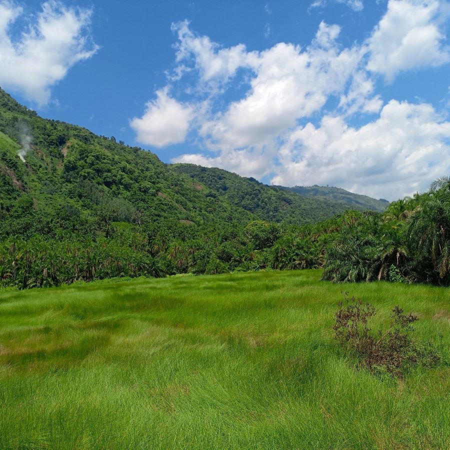
Visitors are drawn to its scenic landscapes, from lowland rainforests to rift valley floors, offering a mix of adventure, wildlife, and cultural immersion.
While the town itself is modest with basic amenities like the 160-bed Bundibugyo General Hospital and murram road networks, it serves as an ideal base for exploring nearby attractions, with accommodations ranging from guesthouses to nearby lodges in Fort Portal.
Location of Bundibugyo Town, Uganda
Bundibugyo Town lies in Uganda’s Western Region at approximately 0°42′40″N, 30°03′53″E. It sits at an elevation of about 1,055 m above sea level on the western foothills of the Rwenzori Mountains.
As the district headquarters of Bundibugyo District, the town anchors the Bwamba Kingdom seat (Obudhingiya Bwa Bwamba).
The district is one of only two in Uganda located west of the Rwenzori range. It borders Ntoroko District to the northeast, Kabarole to the east, Bunyangabu to the southeast, Kasese to the south, and the Democratic Republic of the Congo to the west and north.
By road, Bundibugyo is about 83.6 km (roughly 85 km) west of Fort Portal, the nearest large city, though steep, winding terrain makes direct travel challenging.
Bundibugyo lies approximately 378 km west of Kampala, Uganda’s capital and largest city.
Direct routes to nearby hubs are impeded by the Rwenzori massif. For instance, although Kasese is only 72 km south by straight-line distance, no motorable road cuts through the mountains
Travelers must detour via Bunyangabu, Kabarole, and Ntoroko districts or cross through the Democratic Republic of Congo to reach it.
History of Bundibugyo, Uganda
Bundibugyo Town, the administrative and cultural center of Bundibugyo District in western Uganda, has a rich and multifaceted history shaped by its strategic location, ethnic diversity, colonial influences, and post-independence developments. Nestled in Bwamba County, west of the Rwenzori Mountains and near the border with the Democratic Republic of the Congo (DRC), the town lies approximately 378 kilometers west of Kampala at an elevation of about 900 meters above sea level. With a population of around 21,600 (based on recent estimates), Bundibugyo serves as a hub for the Bamba and Bakonjo peoples, whose historical narratives are intertwined with the region’s evolution from pre-colonial kingdoms to a modern district capital. The town’s history reflects broader Ugandan dynamics, including colonial administration, ethnic interactions, conflict, and economic shifts, particularly its prominence in cocoa production. Below is a detailed exploration of Bundibugyo’s historical development, organized chronologically and thematically.
Pre-Colonial Era: The Foundations of Bwamba and Bakonjo Societies
Before European contact, the area now known as Bundibugyo was part of the Bwamba region, inhabited primarily by the Bamba (also called Banande) and Bakonjo ethnic groups.
These communities were organized into decentralized societies with strong cultural and economic ties to the Congo Basin, given their proximity to the modern DRC border.
The Bamba, who share linguistic and cultural affinities with the Banande of eastern DRC, were primarily agriculturalists and traders, cultivating crops like sorghum, millet, and bananas, and engaging in cross-border trade with neighboring groups.
The Bakonjo, known for their affinity with the Rwenzori Mountains, practiced terraced farming and revered the mountains as sacred, integrating them into their spiritual and cultural practices.
The Bwamba region operated as a semi-autonomous entity under the loose influence of the Toro Kingdom, a Bantu monarchy centered in what is now Kabarole District.
The Toro Kingdom, established in the 1830s by Prince Kaboyo as a breakaway from the Bunyoro Kingdom, exerted nominal control over Bwamba, but local governance rested with clan leaders and elders.
The Bamba maintained a distinct identity, with oral traditions emphasizing their migration from the Congo region centuries earlier.
Archaeological evidence, though limited, suggests early settlements around the Semliki River and Lake Albert, where fishing and trade thrived.
The area’s isolation, due to the Rwenzori Mountains and dense Semuliki forests, preserved its cultural uniqueness but limited integration with larger Ugandan kingdoms.
Colonial Period (1890s–1962): British Influence and Administrative Changes
The arrival of British colonialists in the late 19th century marked a significant shift for Bundibugyo. In 1894, the British declared Uganda a protectorate, and the Toro Kingdom, under Omukama (King) Kasagama, signed agreements aligning with British interests.
Bwamba, including present-day Bundibugyo, was incorporated into the Toro Kingdom’s administrative sphere under British oversight, though its remoteness meant limited direct control.
The British valued the region for its strategic position near the Congo border and its fertile lands, which supported early cash crops.
In the early 20th century, the British formalized administrative boundaries, placing Bwamba under Toro District.
Bundibugyo emerged as a local trading post, with colonial agents establishing outposts to oversee tax collection and labor recruitment.
The Bwamba Pass, a historic trail through the Rwenzori foothills, became a key route for colonial officials and missionaries traveling between Fort Portal and the Congo.
Christian missionaries, particularly from the Church Missionary Society (CMS), introduced formal education and Christianity, building schools and churches in the 1910s–1920s.
These efforts often clashed with traditional Bamba and Bakonjo practices, creating tensions but also fostering literacy and new leadership structures.
Colonial agricultural policies laid the groundwork for Bundibugyo’s modern economy. The British encouraged cocoa cultivation in the fertile lowlands, capitalizing on the region’s ideal climate.
By the 1930s, cocoa became a major export, with Bwamba farmers forming cooperatives to supply colonial markets.
However, colonial rule also marginalized local governance, as British-appointed chiefs often favored Toro elites over Bamba or Bakonjo leaders, sowing seeds of ethnic tension that would resurface later.
Post-Independence and District Formation (1962–1980)
Uganda’s independence in 1962 brought significant changes to Bundibugyo’s administrative status. Initially, the area remained part of Toro District under the Toro Kingdom’s influence within the newly independent Uganda.
However, the Bamba and Bakonjo sought greater autonomy, feeling marginalized by Toro dominance. In the 1960s, the Rwenzururu Movement, led by figures like Isaya Mukirane, emerged among the Bakonjo and Bamba, demanding recognition and self-governance.
This movement, centered in the Rwenzori region, occasionally turned violent, with clashes against Toro and central government forces.
The push for autonomy culminated in 1974, when President Idi Amin’s regime carved out Bundibugyo District from Toro District, naming it after the town.
The name “Bundibugyo” is derived from the Lubwisi language, possibly meaning “place of the Bugyo” (a local term linked to leadership or gathering).
The town became the district headquarters, gaining administrative infrastructure like government offices and a hospital. Amin’s decision was partly strategic, aiming to weaken Toro influence and secure border regions amid tensions with Zaire (now DRC).
However, his regime’s instability limited development, and Bundibugyo remained a remote outpost with basic murram roads and minimal services.
In 1980, after Amin’s fall, the district was renamed Semuliki District to reflect its association with the Semliki River and valley.
However, local preference for the original name led to its reinstatement as Bundibugyo District later that year. The town began to grow as a commercial hub, with cocoa exports driving the economy.
The Bwamba Kingdom (Obudhingiya Bwa Bwamba), formalized in the post-independence era, established its cultural headquarters in Bundibugyo, reinforcing the town’s role as a center for Bamba identity.
Late 20th Century: Conflict and Recovery (1980s–1990s)
The 1980s and 1990s were turbulent for Bundibugyo due to national and regional conflicts. The Ugandan Bush War (1981–1986) disrupted the region, though Bundibugyo’s isolation shielded it from the worst fighting.
More significant was the Allied Democratic Forces (ADF) insurgency, which emerged in the mid-1990s. The Allied Democratic Forces (ADF), a rebel group with bases in the DRC, targeted Bundibugyo District due to its border proximity, launching attacks on villages and infrastructure.
Notable incidents included the 1998 attack on Kichwamba Technical College, near Bundibugyo, where dozens were killed.
These conflicts disrupted tourism potential, despite the establishment of Semuliki National Park in 1993, and strained local resources.
Despite challenges, Bundibugyo Town grew as a service center. The 160-bed Bundibugyo General Hospital, built in the 1980s, became a critical facility, serving the district and parts of the Democratic Republic of Congo (DRC).
Cocoa production expanded, with Uganda becoming a leading exporter, and Bundibugyo’s farmers benefiting from global demand. The town’s markets flourished, attracting traders from Fort Portal and beyond, while cultural festivals strengthened Bamba and Bakonjo identity.
21st Century: Development and Tourism Growth (2000s–Present)
Since the 2000s, Bundibugyo Town has experienced gradual development, driven by peace, infrastructure improvements, and tourism.
The Allied Democratic Forces’ influence waned after Ugandan military operations and cross-border cooperation with the DRC, though sporadic incidents persisted into the 2010s.
The town’s infrastructure, including murram roads connecting to Fort Portal and Kasese, improved access, though heavy rains still pose challenges.
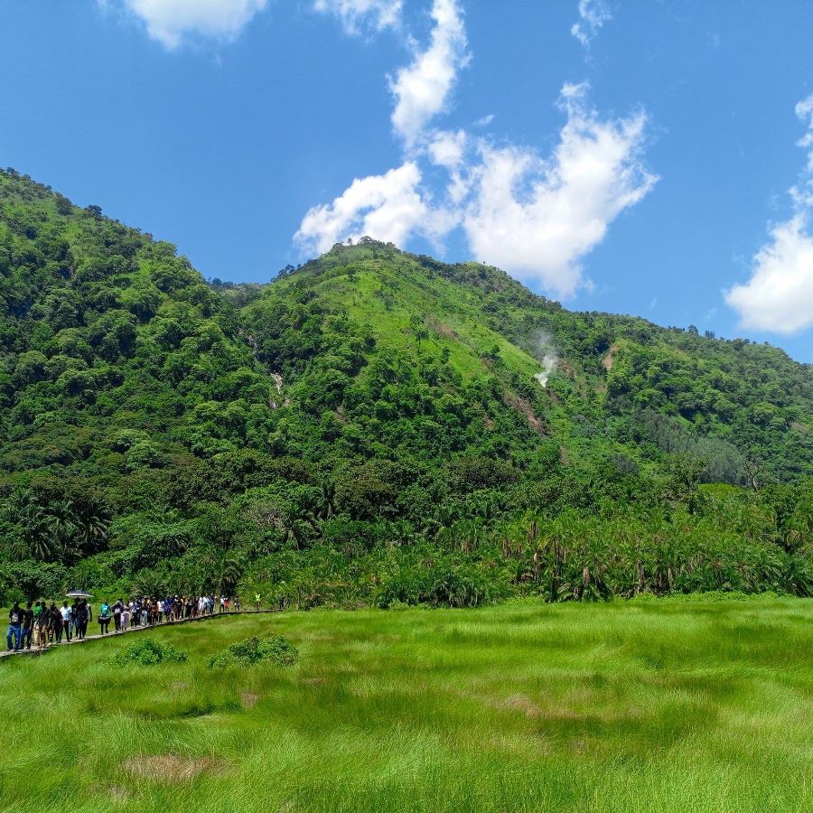
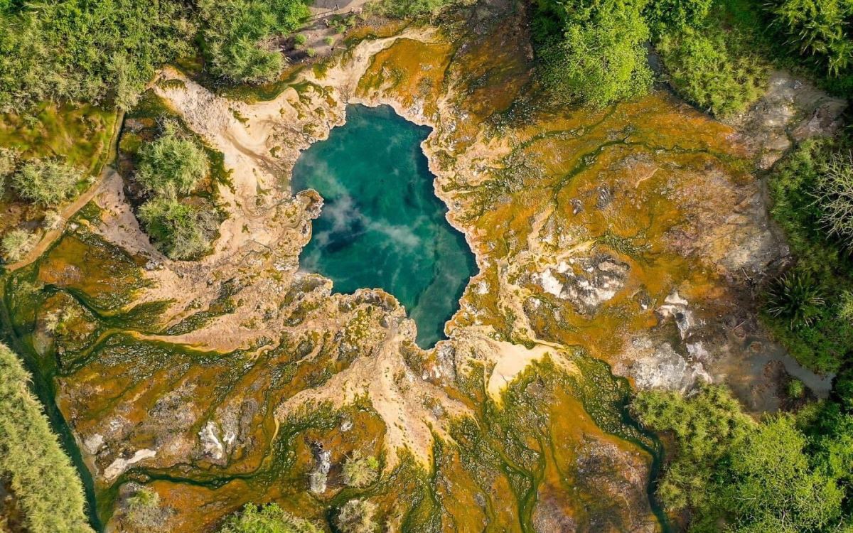
The establishment of Semuliki National Park as a tourism hub, with its Sempaya Hot Springs and biodiversity, put Bundibugyo on the map for eco-tourists.
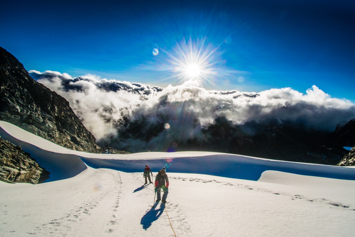
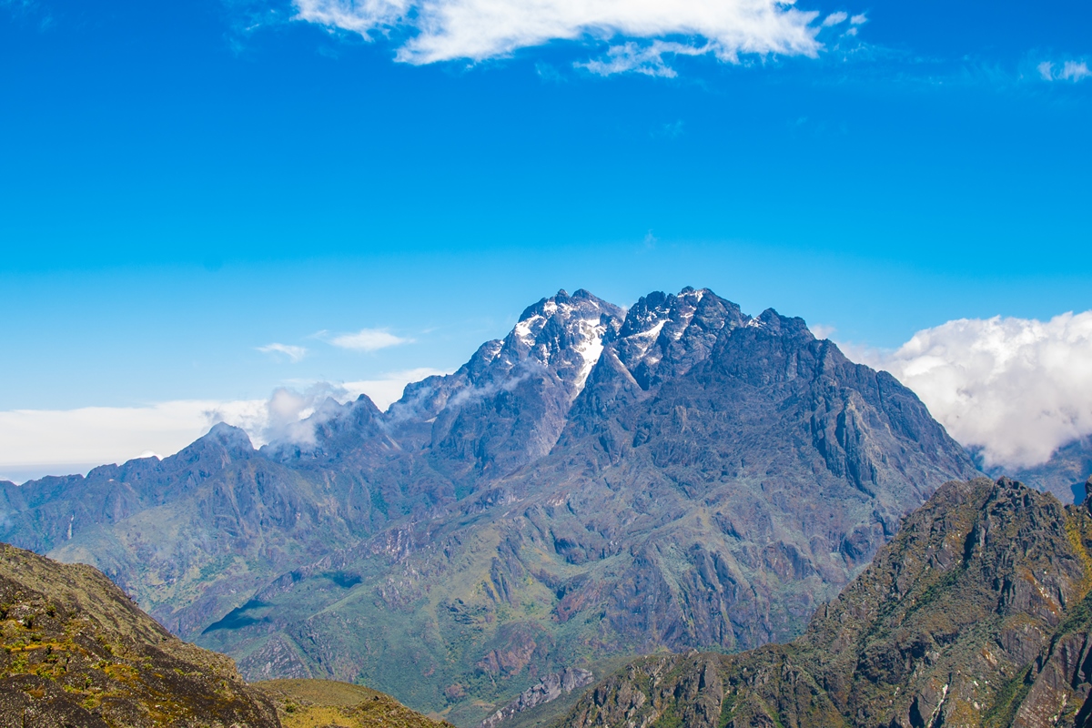
The Rwenzori Mountains National Park, a United Nations Educational, Scientific and Cultural Organization (UNESCO) World Heritage Site since 1994, further boosted the region’s profile, with Bundibugyo serving as a northern gateway.
Administratively, Bundibugyo District faced adjustments, with parts hived off to form Ntoroko District in 2010, but the town retained its status as the district capital.
The Bwamba Kingdom gained recognition under Uganda’s cultural institution framework, fostering pride and cultural tourism.
Investments in education, with schools like Bundibugyo Secondary School, and health services strengthened the town’s role as a regional hub.
Cocoa remains the economic backbone, with Bundibugyo producing billions in unprocessed beans annually, though efforts to add value through processing are ongoing.
Recent challenges include Ebola outbreaks in 2007 and 2012, linked to the town’s proximity to the Democratic Republic of Congo (DRC), which tested its health infrastructure.
However, community resilience and international aid helped mitigate impacts. Today, Bundibugyo is promoted as a tourism base, leveraging its access to Semuliki, Rwenzori, and Toro-Semuliki Wildlife Reserve, alongside cultural attractions like Batwa (pygmy) villages and Bwamba festivals.
Cultural and Economic Significance
Bundibugyo’s history is inseparable from its cultural and economic roles. The Bwamba Kingdom, with its palace in town, preserves traditions through dances, storytelling, and festivals, attracting cultural tourists.
The Bakonjo’s connection to the Rwenzori Mountains adds a spiritual dimension, with myths like the “Mountains of the Moon” enhancing tourism appeal.
Economically, cocoa has shaped the town since colonial times, with modern efforts focusing on sustainable farming and global markets.
The town’s border location fosters cross-cultural exchange with the DRC, evident in markets and shared Banande heritage.
Bundibugyo Town’s history is a tapestry of resilience, cultural richness, and adaptation. From its pre-colonial roots as a Bamba and Bakonjo stronghold to its role as a colonial outpost and modern district capital, the town has navigated challenges like conflict and isolation while leveraging its natural and cultural assets.
The town’s emergence as a tourism gateway, driven by Semuliki and Rwenzori attractions, and its cocoa-driven economy underscore its evolving significance.
Despite its remoteness, Bundibugyo’s historical journey reflects Uganda’s broader narrative of diversity, struggle, and growth, making it a compelling destination for those seeking to understand the region’s past and present.

