
Kisoro Town Travel Guide | Towns and Cities, Uganda
Kisoro is a picturesque town nestled in the Western Region of Uganda, serving as the chief town of Kisoro District. This town lies approximately 76 kilometers west of Kabale and about 484 kilometers southwest of Kampala, Uganda’s capital.
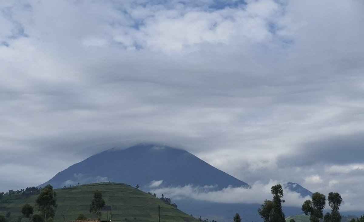
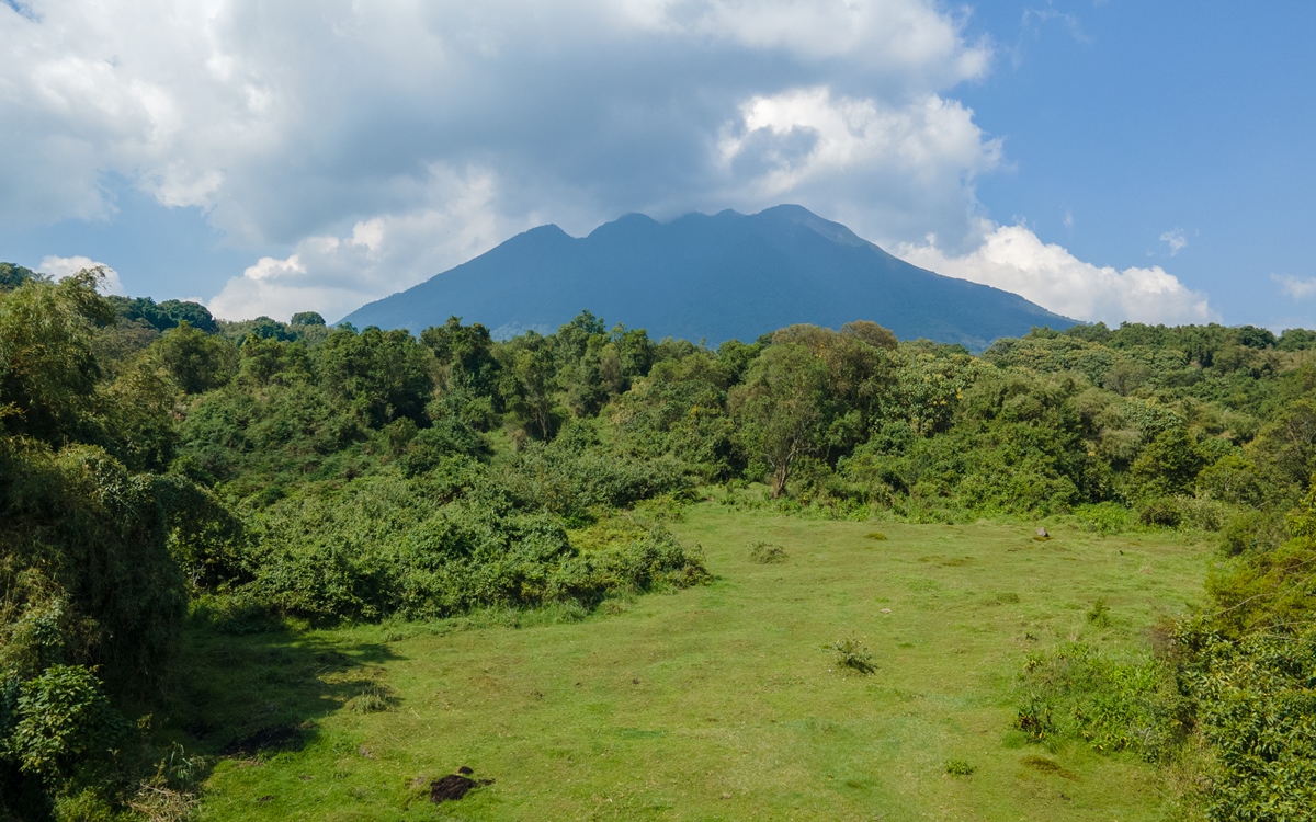
Kisoro is uniquely positioned near the Virunga Mountains, making it a gateway to Mgahinga Gorilla National Park, a haven for the rare mountain gorillas.
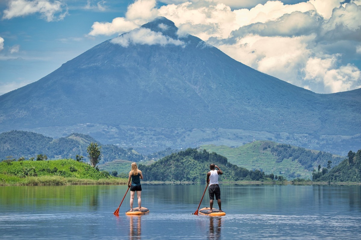
The town is surrounded by breathtaking mountain scenery, Lake Mutanda, and vibrant local markets, making it a magnet for tourists seeking adventure and cultural experiences.
Kisoro’s elevation of 1,929 meters above sea level adds to its cool climate and stunning landscapes. Whether you're interested in volcano trekking, gorilla tracking, or simply soaking in the beauty of Uganda’s southwestern region, Kisoro offers an unforgettable experience.
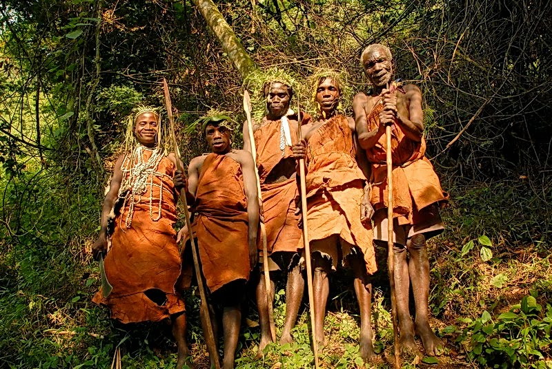
Culture enthusiasts will have a good time learning about and interacting with the people who inhabit the Mutanda Island - Abagesera.
Location of Kisoro Town, Uganda
Kisoro is a town located in the South-Western part of Uganda, near the border with Rwanda and the Democratic Republic of the Congo. It’s surrounded by beautiful scenic views of mountains, forests, and lakes. The geographical coordinates of Kisoro are approximately 1°17’06.0"S latitude and 29°41’06.0"E longitude.
This charming town is situated under the peaks of the Mufumbiro Mountains, which are part of the Virunga Mountains and home to rare mountain gorillas. If you’re interested in gorilla tracking, Kisoro is the nearest town to the Mgahinga Gorilla National Park and serves as an access point for travelers heading to Rwanda or the DRC for gorilla treks in the Volcanoes National Park or the Virunga National Park.
Population of Kisoro Town, Uganda
Kisoro District in Uganda has an approximate population of 12,400 people in 2024 as indicated by the Uganda Bureau of Statistics.
History of Kisoro Town, Uganda
Kisoro Town, located in southwestern Uganda, has a rich and complex history shaped by its geographical position, cultural heritage, and colonial influences.
Historically, Kisoro was part of the Kingdom of Rwanda, with the Bafumbira people as its indigenous inhabitants. The region was deeply connected to Rwandan traditions, language, and governance. Oral history suggests that Kisoro was influenced by legendary figures such as King Ruganzu Ndoli II, who is said to have created underground water sources using supernatural powers. These water sources, including Mwihe, Chuho, Mwambike, and Nkanka springs, remain significant to local communities today.
During the early 20th century, British colonial rule reshaped Kisoro’s identity. In 1910, the British incorporated the area into Uganda, separating it from Rwanda. Kisoro remained part of the Kigezi District until 1991, when it was officially designated as Kisoro District. The colonial administration introduced new governance structures, economic activities, and infrastructure, influencing the town’s development.
Following Uganda’s independence in 1962, Kisoro continued to evolve as a strategic border town near Rwanda and the Democratic Republic of Congo. The town’s location made it a hub for trade, migration, and tourism. Kisoro town’s proximity to Mgahinga Gorilla National Park and Bwindi Impenetrable National Park has made it a key destination for mountain gorilla trekking, attracting visitors from around the world.
Today, Kisoro is a vibrant town with a mix of traditional and modern influences. The town boasts a diverse population, with Kinyarwanda and Rufumbira as widely spoken languages. The town’s economy thrives on agriculture, tourism, and cross-border trade. Despite challenges such as water scarcity, Kisoro remains an important cultural and economic center in Uganda.

