Lake Bunyonyi Tourist Attraction: Islands, Scenic Landscapes and Adventure Experiences in Southwestern Uganda
Tucked away in the terraced hills of southwestern Uganda, Lake Bunyonyi is widely celebrated as one of the most beautiful and scenic landscapes in Africa.
This tourist attraction name translates to "the place of little birds," a nod to the vibrant avian life that populates its shores and wetlands.
Believed to be the second-deepest lake on the continent, Bunyonyi stretches beautifully between the districts of Kabale and Kisoro.
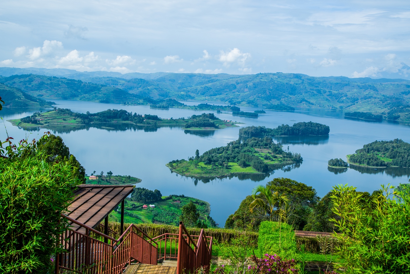
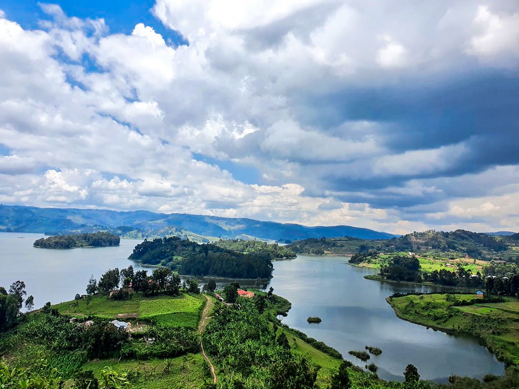
Lake Bunyonyi is globally recognized for its signature layout: a winding body of water dotted by 29 distinct islands, each wrapped in local folklore, history, and ancient cultural myths.
What truly sets Lake Bunyonyi apart from other East African water bodies is its exceptional safety.
Because it is completely free from bilharzia, crocodiles, and hippos, it stands as a rare paradise where travelers can swim, canoe, and paddleboard without worry.
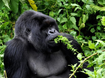
Commonly positioned as the ultimate rest and relaxation hub, it offers a peaceful, mist-veiled sanctuary for trekkers looking to unwind immediately after a demanding mountain gorilla safari in the nearby forests of Bwindi Impenetrable National Park or Mgahinga Gorilla National Park.
Location of Lake Bunyonyi, Uganda
Lake Bunyonyi is situated in the southwestern corner of Uganda, nestled within the Kigezi sub-region near the international border with Rwanda. Administratively, the lake is shared between Kabale and Kisoro districts, lying approximately 7 kilometers west of Kabale Town.
Geographically, Lake Bunyonyi is positioned roughly 410 kilometers southwest of the capital city, Kampala, and sits tightly between two major gorilla conservation areas: Bwindi Impenetrable National Park to the north and Mgahinga Gorilla National Park to the southwest.
Lake Bunyonyi Hotels
Lake Bunyonyi features a variety of accommodations ranging from budget-friendly lakefront lodges to more upscale resorts. Here are several well-rated accommodation options to consider:
Birdnest @ Bunyonyi Resort:
A 4-star option known for its excellent views and amenities, consistently highly rated by guests for its comfort and service.
Nyamunyonyi Lake Resort: A highly-regarded 3-star resort that offers a peaceful environment and a well-reviewed dining experience.
Bunyonyi Safaris Resort:
A popular 3-star choice that provides a balance of comfort and accessibility for those exploring the lake.
Byoona Amagara Island Retreat:
Situated on an island, this retreat offers a more unique, immersive experience for travelers looking to get away from the main shores.
Bunyonyi Overland Resort:
A well-known 2-star, casual lakefront property that is a classic option for budget-conscious travelers, offering a restaurant, bar, and convenient access to the water.
When choosing, consider whether you prefer the convenience of being on the mainland or the seclusion of staying on one of the lake's islands.
Lake Bunyonyi History, Uganda
The history of Lake Bunyonyi is a fascinating mix of cataclysmic geology, rich local mythology, anti-colonial resistance, and deep cultural traditions.
Geological Formation
About 18,000 years ago, volcanic activity in the Virunga Mountains caused a massive lava flow that blocked the Ndego River valley near Muko.
The blocked water rose over time, flooding the steep, V-shaped valleys of the surrounding highlands. The 29 islands present in the lake today are the peaks of the ridges that were submerged during this volcanic event.
Traditional Bakiga Customs at Akampene Island
In the historical traditions of the local Bakiga people, adherence to social codes regarding marriage was strictly enforced.
Unmarried women who became pregnant were taken to Akampene (Punishment Island) and left there.
Because swimming was not a widely shared skill in the region, stranded women remained on the island unless they were collected by men who could not afford a traditional dowry. This practice ended in the 1940s.
Anti-Colonial Resistance
During the early 20th century, the lake's geography was utilized for political resistance. Around 1914, Bwama Island the largest island on the lake, became a central base for Katuregye, a regional leader who organized armed resistance against British colonial administration and tax implementation in the Kigezi district.
The Bwama Leprosy Settlement
In the early 1930s, British medical missionary Dr. Leonard Sharp established a voluntary isolation and treatment center for leprosy patients on Bwama Island.
Dr. Sharp built a hospital, patient quarters, and a church on the island to manage the disease within the region.
He lived on the nearby Njuyeera Island, where he established residential quarters and a botanical garden.
Ecological Interventions
The lake originally supported very few native fish species due to its extreme depth and specific chemical composition.
Throughout the mid-to-late 20th century, agricultural and fisheries departments introduced several species to the water body, including Nile Tilapia, Mirror Carp, and the Louisiana Red Swamp Crayfish, which successfully established populations in the ecosystem.
Lake Bunyonyi Formation
The formation of Lake Bunyonyi is a textbook example of a lava-dammed lake.
Unlike many of the neighboring water bodies in the East African Rift system, Lake Bunyonyi is not a volcanic crater or a tectonic rift basin; rather, it is a drowned river valley system.
Here is a detailed breakdown of the geological events and processes that created Lake Bunyonyi:
The Pre-Existing River Valley
Before the lake existed, the landscape of the Kigezi highlands consisted of an extensive network of deep, V-shaped valleys carved out by rivers and streams over millions of years.
The primary river draining this specific watershed was the Ndego River. This river, along with its various tributaries, flowed through a rugged terrain composed of ancient, highly compressed metamorphic rocks (mainly shales, siltstones, and quartzites) belonging to the Karagwe-Ankolean system.
Volcanic Eruptions and Lava Flow
During the Late Pleistocene epoch, roughly 18,000 years ago, intense volcanic activity occurred along the nearby Virunga Volcanic Field (a chain of volcanoes spanning the borders of Uganda, Rwanda, and the Democratic Republic of Congo).
A massive volcanic eruption released a high-volume flow of molten basaltic lava. This lava surged northward, following the natural contours of the land, and poured directly into the narrow exit channel of the Ndego River valley near present-day Muko (located at the northwestern tip of the modern lake).
The Creation of the Natural Dam
As the molten lava encountered the cooler river water and the restricted topography of the valley exit, it slowed down, solidified, and piled up rapidly.
This created a massive, solid basaltic barrier that acted as a highly effective natural dam. The dam completely blocked the original drainage pathway of the Ndego River, preventing its waters from flowing outward toward the lower plains.
Back-Flooding and the Drowned Landscape
With its only outlet permanently sealed by volcanic rock, the Ndego River and its tributaries had nowhere to drain.
Water began to back up behind the lava dam, steadily rising and flooding the deep, interconnected mountain valleys.
As the water level rose, it submerged everything in the lower elevations of the valley system:
The 29 Islands: The signature islands that characterize Lake Bunyonyi today such as Bwama, Akampene, and Njuyeera are actually the peaks and ridges of ancient hills that were high enough to escape complete submersion when the valley flooded.
The Winding Shape: The lake's irregular, contorted shoreline closely mirrors the original path of the ancient river channels and their dendritic (tree-like) branching drainage patterns.
Key Physical Characteristics Resulting from Lake Bunyonyi Formation
Because of the unique way it was formed, Lake Bunyonyi possesses distinct physical parameters:
Extreme Depth:
Because it flooded steep, V-shaped mountain chasms rather than a flat plain, Lake Bunyonyi is exceptionally deep.
The lake's depth varies significantly across its channels, with maximum depths estimated between 44 meters (144 feet) and 900 meters (2,952 feet) depending on the valley cross-section, making it one of the deepest lakes in Africa.
High Altitude:
Lake Bunyonyi sits at an elevation of approximately 1,962 meters (6,437 feet) above sea level, nestled high within the temperate Kigezi highlands.
Absence of Large Aquatic Predators:
Because it was originally an isolated upland river system trapped suddenly by a lava flow, large river-dwelling African megafauna like crocodiles and hippos were never part of the ecosystem, and the geographic isolation prevented them from colonizing the lake later.